Last of a three-part series exploring local nature destinations
This week, I will conclude my exploration of some of the best nature-viewing areas in the Kawarthas – and beyond – by looking at destinations located mostly south of Peterborough. Almost all of these areas offer excellent opportunities to see a wide range of species and not just those mentioned in the highlights.
For a detailed list of what bird species can be found in the more popular locations (e.g., Briar Hill Bird Sanctuary, Rice Lake – Pengelly Landing, Presqu’ile Provincial Park) go to ebird.org. Click on Explore Data, Explore a Region, type in Peterborough (or another county such as Northumberland), click on Hotspots, click on the destination of your choice and then click on Bar Charts. You will see a list of all birds seen, along with their seasonal abundance.
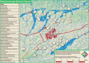
Nature destinations in the Kawarthas (note: Not all of the destinations in this article appear on the map) – Dylan Radcliffe
Briar Hill Bird Sanctuary: Located on north-west corner of Co. Rd. 21 and 28. Highlights: Waterfowl and shorebirds, especially during spring and fall migration. A spotting scope is necessary.
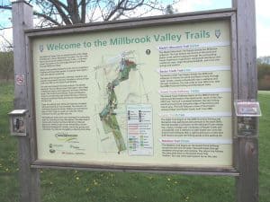
Millbrook Valley Trails: Take Distillery St. south from King St. in Millbrook and park at trailhead near the millpond. Highlights: Check the millpond for ducks, geese and shorebirds. The Baxter Creek Trail (3 km) traverses a diversity of habitat types including cedar-hemlock forest, extensive wetland (boardwalks) and meadows, each with its representative birds and plants. This is a great trail for wetland flowers, shrubs and birds. Finish up with coffee at the Pastry Peddler Café in downtown Millbrook!
Pleasant Point Rd: From Co. Rd. 21, take 4th Line east. Highlights: Screech owls possible all year round in wooded areas along road. Large variety of warblers such as Northern Waterthrush and Black-throated Blue in the low, swampy forests.
Gravel Pit Conservation Area: Located at south end of Crowley Line, which is one line east of Bensfort Rd. Park where Crowley turns west and becomes Rosa Landing Road. Walk in along unmaintained road allowance, which continues south. Climb over gate on left. Continue until you arrive at a large open area with ponds. Highlights: Good general birding, shorebirds possible at ponds during migration
Scriven Road: Located one line east of Bailieboro, between 4th Line and the north shore of Rice Lake. Highlights: A good place to look for Snow Buntings, Horned Larks, Snowy Owls and Red-tailed Hawks in winter. Field birds like Eastern Meadowlarks and Bobolinks in spring and summer.
Rice Lake (Pengelly Point to Hiawatha): Take Co. Rd. 2 east from Bailieboro. Turn south at Scriven Rd. and follow to Pengelly Point on Rice Lake. Check lake in all directions. Further east, good views of the lake can also be had from Bb Beach Rd., Perrin Point Rd., Southview Dr., Wood Duck Dr. and from Harrick Point in Hiawatha First Nation. Highlights: Rafts of migrating ducks in early spring (late March through early April) and in late fall. Excellent area for Osprey, too.
Herkimer Point Road: Turn east off Co. Rd. 31 at Hiawatha First Nation. Highlights: Excellent birding from spring to fall in a variety of habitats, including deciduous forest, swamp and marsh. Good views of Rice Lake from the end of the road, where there is a nice woodlot with wildflowers such as Wild Geranium. Bird species to expect in marshes include Virginia Rail and American Bittern.
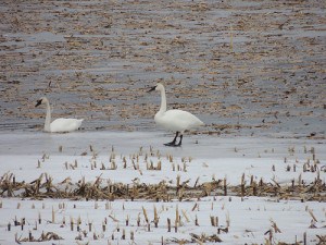
Mather’s Corners: Located east of Drummond Line, just south of Co. Rd. 2 at Mather’s Corners. Highlights: Ducks, geese and sometimes swans in early spring in flooded cornfield. They include Northern Pintail, Green-winged Teal, Northern Shoveler and sometimes even Snow Geese and Tundra Swans. The birds are best viewed with a spotting scope from Drummond Line. Continue to south end of road where there is a heronry with large numbers of nesting Great Blue Herons. The fields here are often good for Bobolinks and Eastern Meadowlarks.
Indian River at Keene: Large wetland located just east of village. Explore north and south of the bridge by canoe. Highlights: Typical wetland plants, amphibians, reptiles and birds such as Virginia Rail and Marsh Wren.
Indian River at Warsaw: At village of Warsaw, take Rock Rd. east about 1 km to Back Dam Park. You can look for birds from the parking lot or explore the river by canoe or kayak. Highlights: Good general birding in spring and early summer. Common Nighthawks migrate south over the river in late afternoon and evening, from mid-August through early September. 50 or more possible on a good evening.
River Road – Take 2nd Line of Asphodel south from Co. Rd. 2. River Rd. is first road on left. Follow across to 6th of Asphodel. Highlights: Beautiful old forest with impressive mature trees, diverse ferns, abundant spring wildflowers and sometimes birds like Red-bellied and Red-headed Woodpecker.
Trans-Canada Trail East (Peterborough to Hastings and beyond): Section between Drummond and David Fife Lines can be very good, especially where it borders the wetland east of Nelson Road. Highlights: Excellent birding and butterfly –watching from May through early fall. Watch for Baltimore Checkerspot butterflies east of Nelson Road where Turtlehead wildflowers grow.
A little further afield…
Ballyduff Trails (McKim-Garsonnin Property): Take Hwy 7A to Hwy 35. Head south to Ballyduff Rd. Turn right and continue to Wild Turkey Rd. Park at 851 Ballyduff Rd. Parking is also available at 1020 Gray Rd. (South Pond Farms), located north of Wild Turkey Rd. Highlights: Explore five trails winding through meadow, forest, wetland and a tall grass prairie restoration project. Go to Kawarthalandtrust.org to print off a trail map.
Fleetwood Creek Natural Area: Continue on Ballyduff Rd. past Wild Turkey Rd. and watch for signs. Highlights: 380-hectare property located within the Oak Ridges Moraine. Trails take you through mature lowland forests, meadows and steep valleys. You will find a diverse flora, interesting geology and impressive fall foliage.
Nonquon Sewage Lagoons: Located on Scugog Line 8, east of Highway 12, north of Port Perry. Highlights: Diverse and sometimes abundant migrating shorebirds in spring, summer and fall. Close-up views. N.B. a ten-dollar permit is necessary. Obtain at Durham Region Transfer Site at 1623 Reach Road, Port Perry. Call 905-985-7346 ext. 112 for more information.
Peter’s Woods Provincial Nature Reserve – From Co. Rd. 28 at Bewdley, travel east on Co. Rd. 9 and Co. Rd. 29 to McDonald Rd. Turn right (south) on McDonald Rd. to the reserve. Highlights: Magnificent old-growth forest with huge maples, beech, ash, pine, etc. Diverse ferns, orchids, spring wildflowers and birds.
Second Marsh – McLaughlin Bay Wildlife Reserve – Take Highway 401 east towards Oshawa. Take exit 419. Turn left onto Bloor St. E, then left onto Regional Road 56 and left onto Colonel Sam Dr. Follow to Reserve entrance on right. Highlights: 137-hectare provincially significant coastal wetland; important breeding and migratory stopover area for birds; numerous trails, interpretive signs, viewing platforms with excellent opportunities to see shorebirds, waterfowl, field birds, raptors, etc. Scope will come in handy.
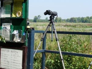
Cranberry Marsh – Take Highway 401 east towards Whitby. Exit at Brock St. (exit 410). Go south 0.5 km to Victoria St. (eastern extension of Bayly). Turn right, go 3.2 km to Hall’s Rd. Turn left, and follow to roadside parking area at pathway. Leads to platform over the marsh. Highlights: Waterfowl (both in marsh and along the lakeshore), owls, migrant songbirds. Excellent hawk-watching in fall. Especially mid-September for Broad-winged Hawks.
Thickson’s Woods – From Highway 401 in Whitby, Ontario, take Thickson Road south past Wentworth Street to the Waterfront Trail. Turn east (left) 100 metres to a small turnaround. Highlights: Last remnant of old-growth white pines on the north shore of Lake Ontario. Superb late April – early May destination for migrating songbirds like warblers, orioles, tanagers and thrushes.
Cobourg Harbour – From Exit 474 on Highway 401, go south on Division St. (Highway 45) to east pier. Highlights: A great place to see wintering and migrant gulls, ducks and sometimes Snowy Owls. October to April is best. Migrant shorebirds often show up along the west side. Further lake views can be had from the foot of D’Arcy St. where more gulls, grebes waterfowl often loiter. Flat rocks here contain fossils. Port Hope Harbour on Mill St. is also excellent.
Ganaraska River – Corbett’s Dam: Follow Co. Rd. 28 to first set of traffic lights south of Highway 401. Go west on Molson St. and turn right at Cavan St. Follow to Corbett’s Dam where the fish ladder is located. Highlights: In April, watch Rainbow Trout making the run upstream to spawn. In September, Chinook Salmon can be seen jumping up the ladder and waiting in the hundreds in the water below the dam.
Presqu’ile Provincial Park – Located south of Brighton on Lake Ontario. Follow signs. Highlights: The 10-km-long peninsula jutting into Lake Ontario is a migrant trap for many species of birds. Waterbirds and shorebirds migrate through in large numbers. Unique late-summer wildflowers including False Dragonhead, Grass-of-Parnassus and Kalm’s Lobelia. Staging area for migrant Monarch butterflies in late summer. Special event weekends include Waterfowl Viewing Weekend in March and the Monarchs and Migrants Weekend at Labour Day. If you go to Presqu’ile, be sure to check out the Brighton Constructed Wetland for ducks and other wetland species. It is located at 211 Prince Edward St. (at junction of Harbour St.) about 2 km east of the park entrance.
